Blog
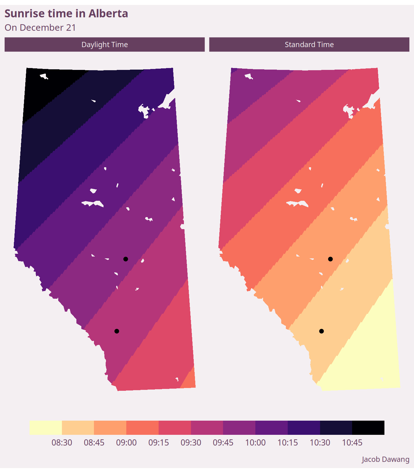
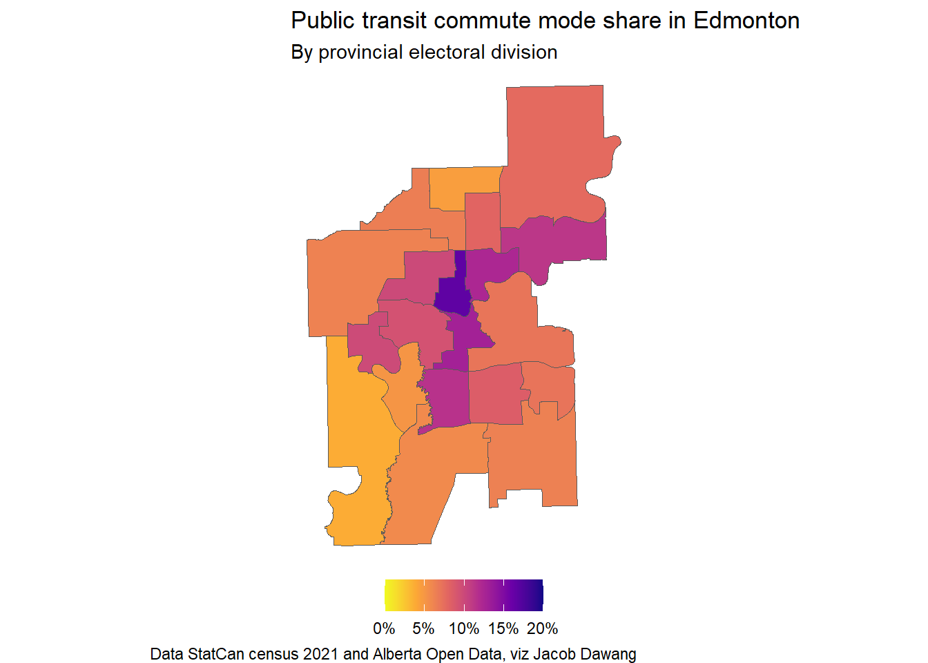
Visualizing Alberta’s shift to permanent daylight time
alberta
edmonton
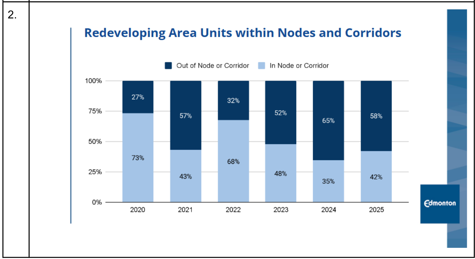
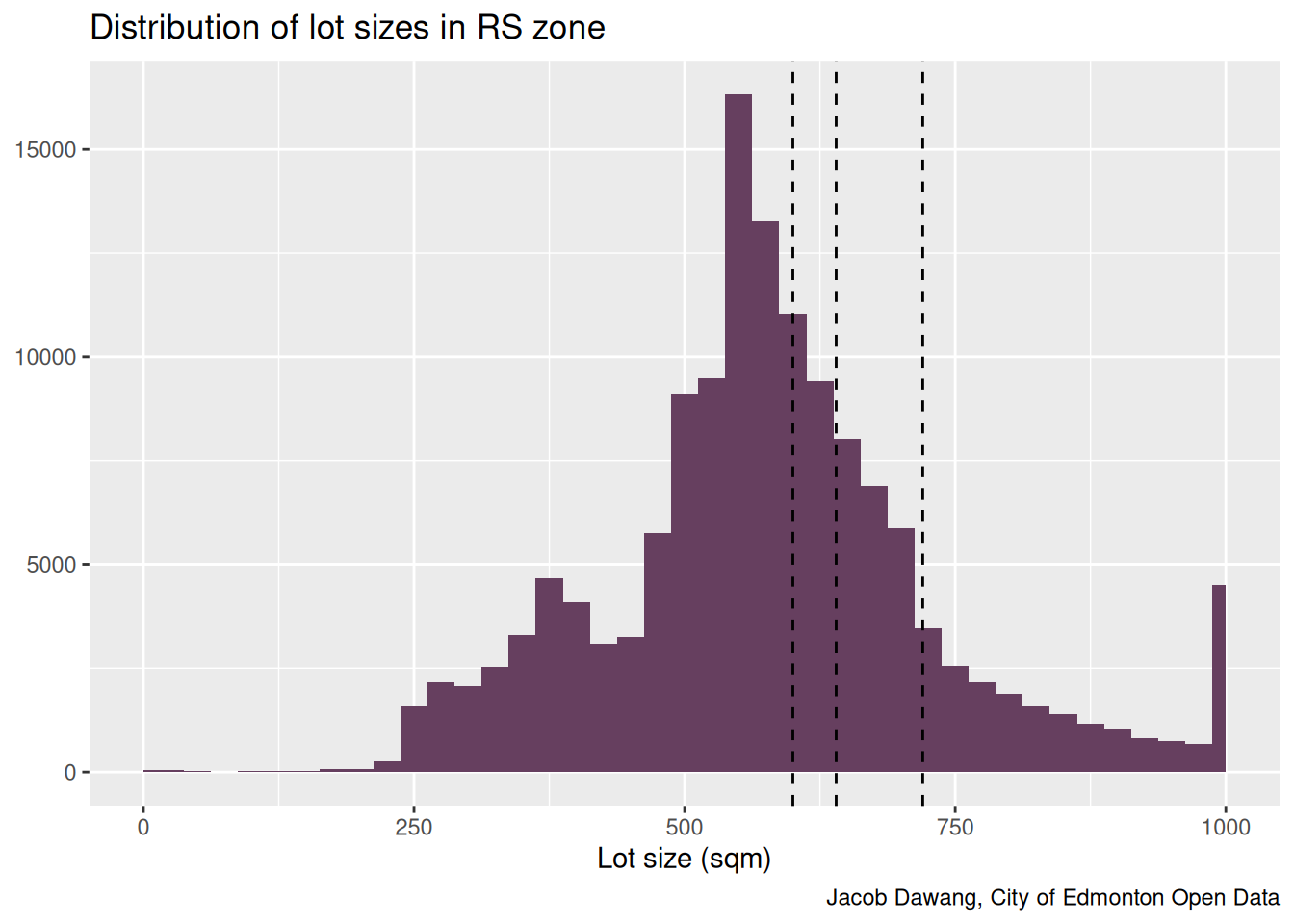
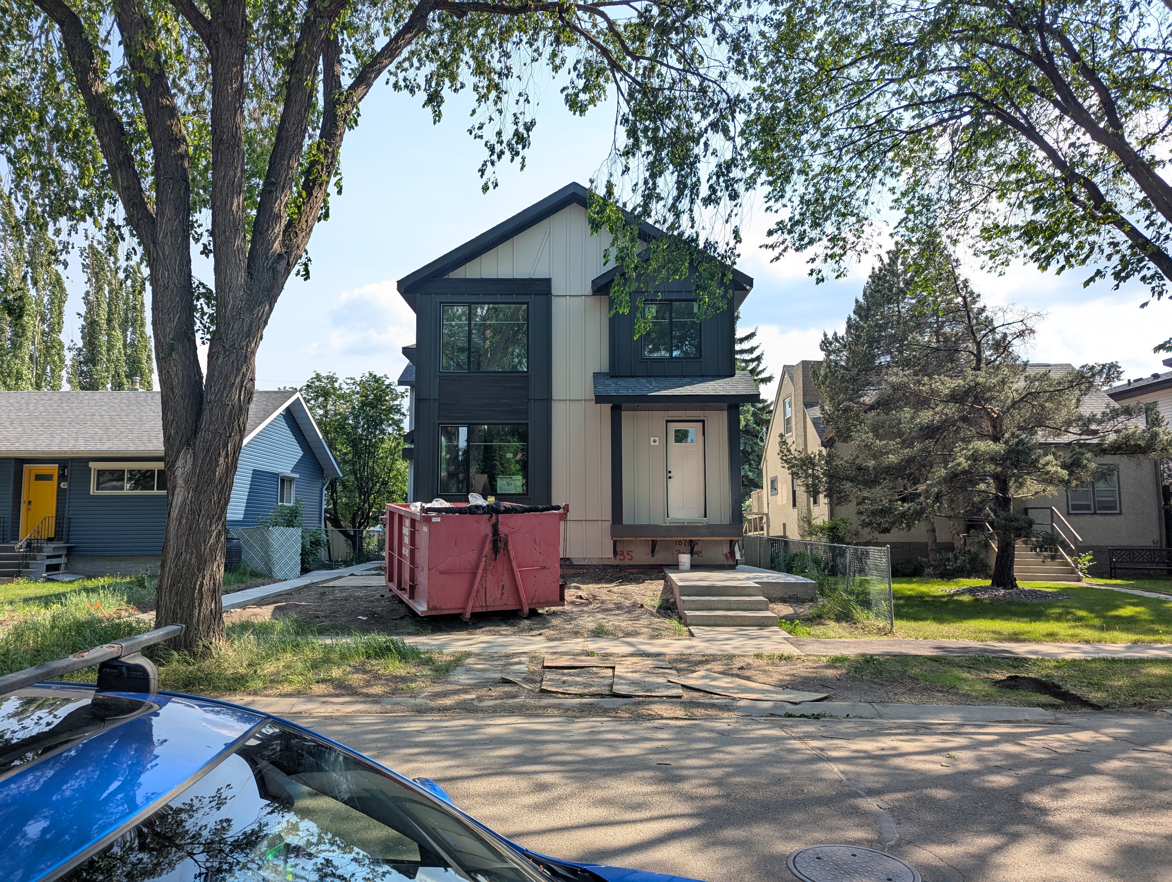
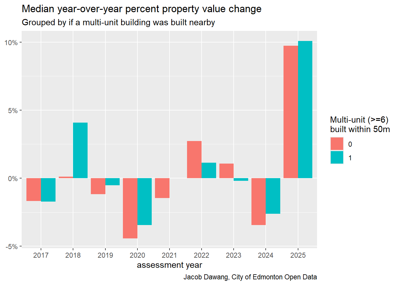
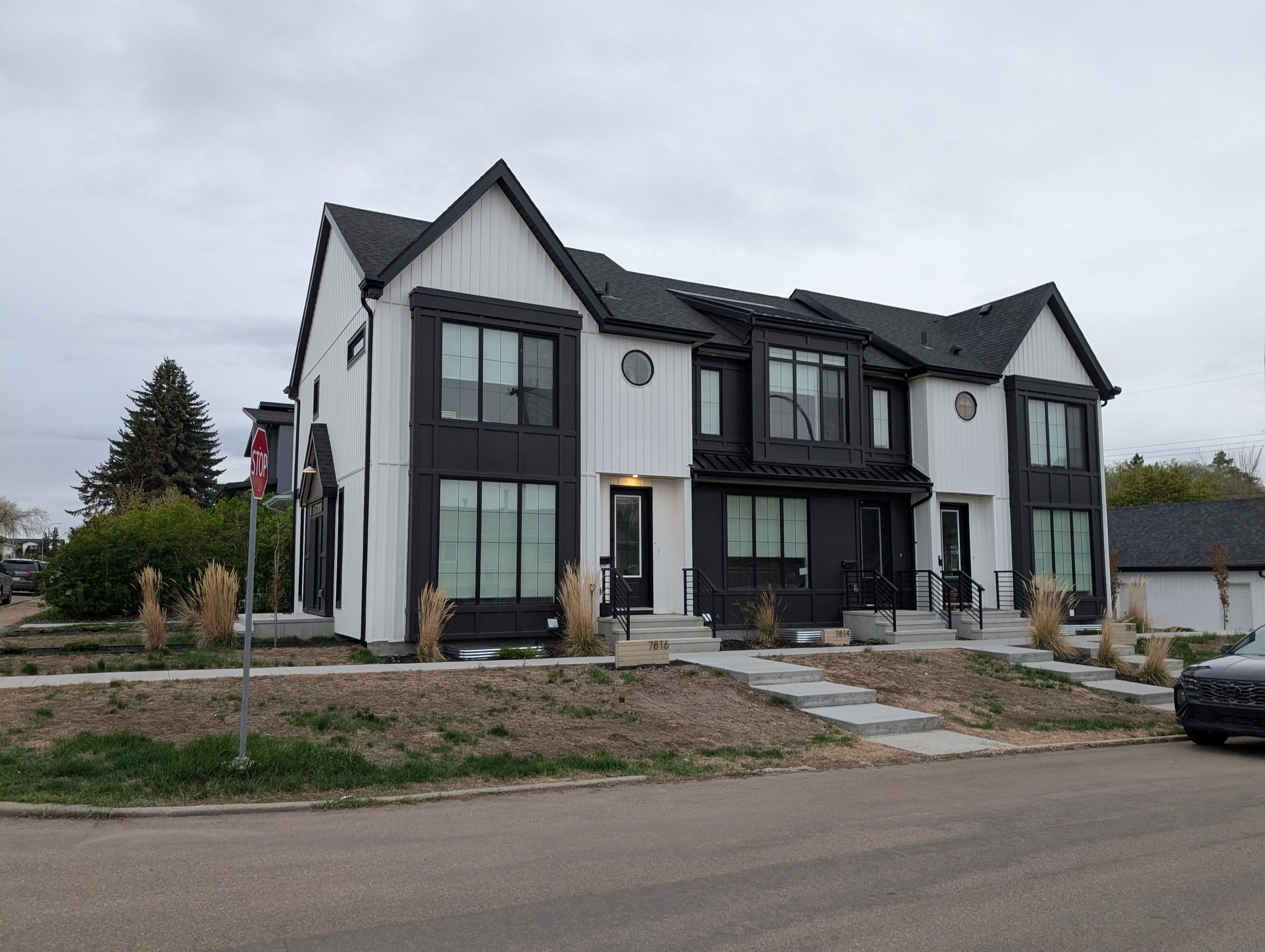
A quick look at infill’s effect on property values
housing
edmonton
zoning
property value
![]()
Zoning By-Law Renewal: One Year Review
housing
transit
edmonton
Op-ed: Rezoning in Garneau will improve housing options for everyone
housing
priority growth areas
edmonton
opinion
Updated district plan profile for each LRT station
map
data
housing
district planning
transit
edmonton

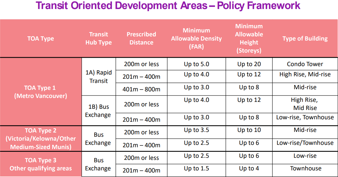
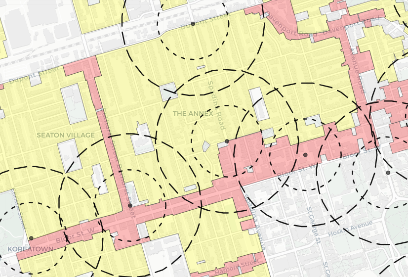
Land use and growth around Edmonton’s LRT stations
map
data
housing
district planning
transit
edmonton
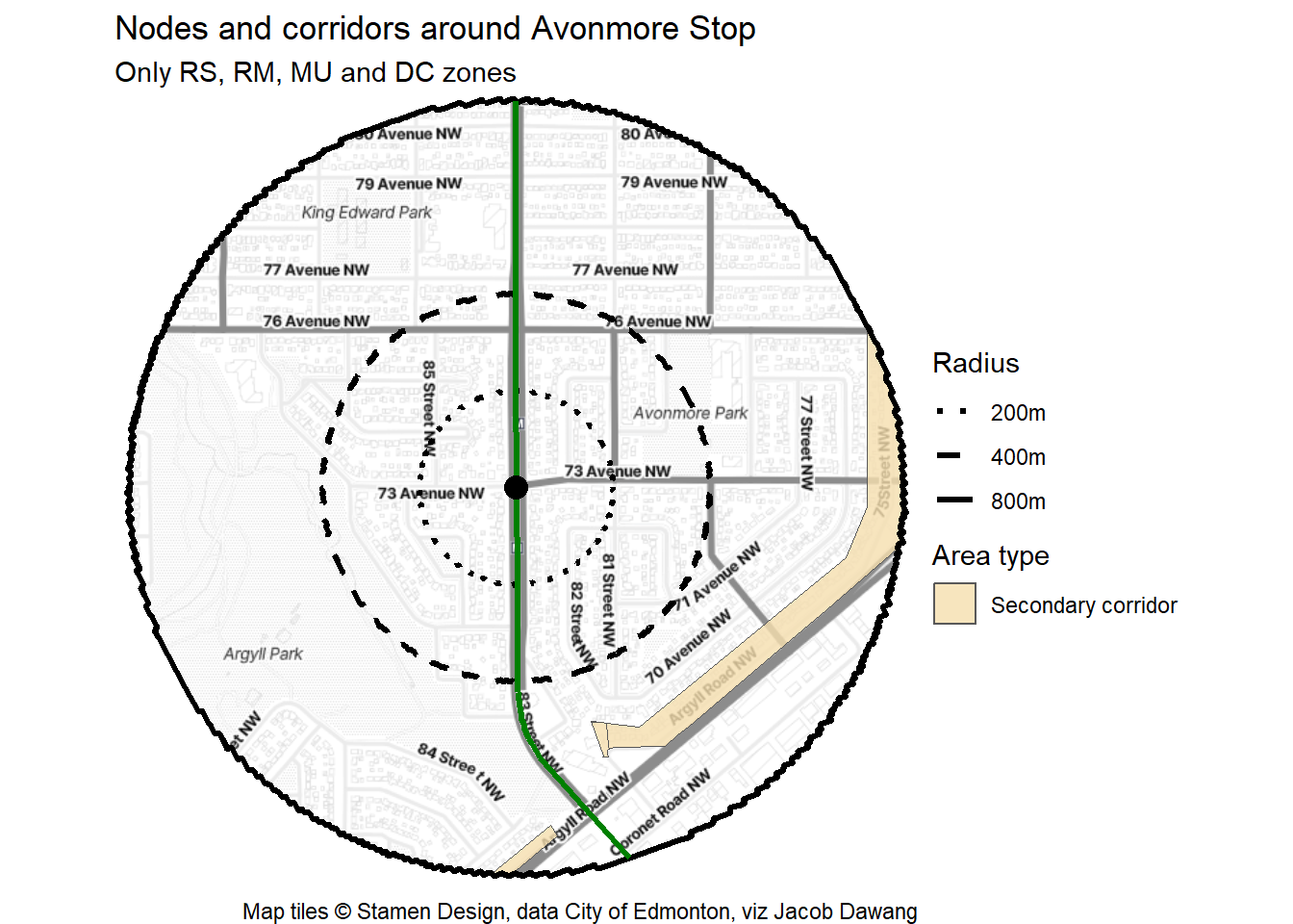
Avonmore Stop
map
data
housing
district planning
transit
edmonton
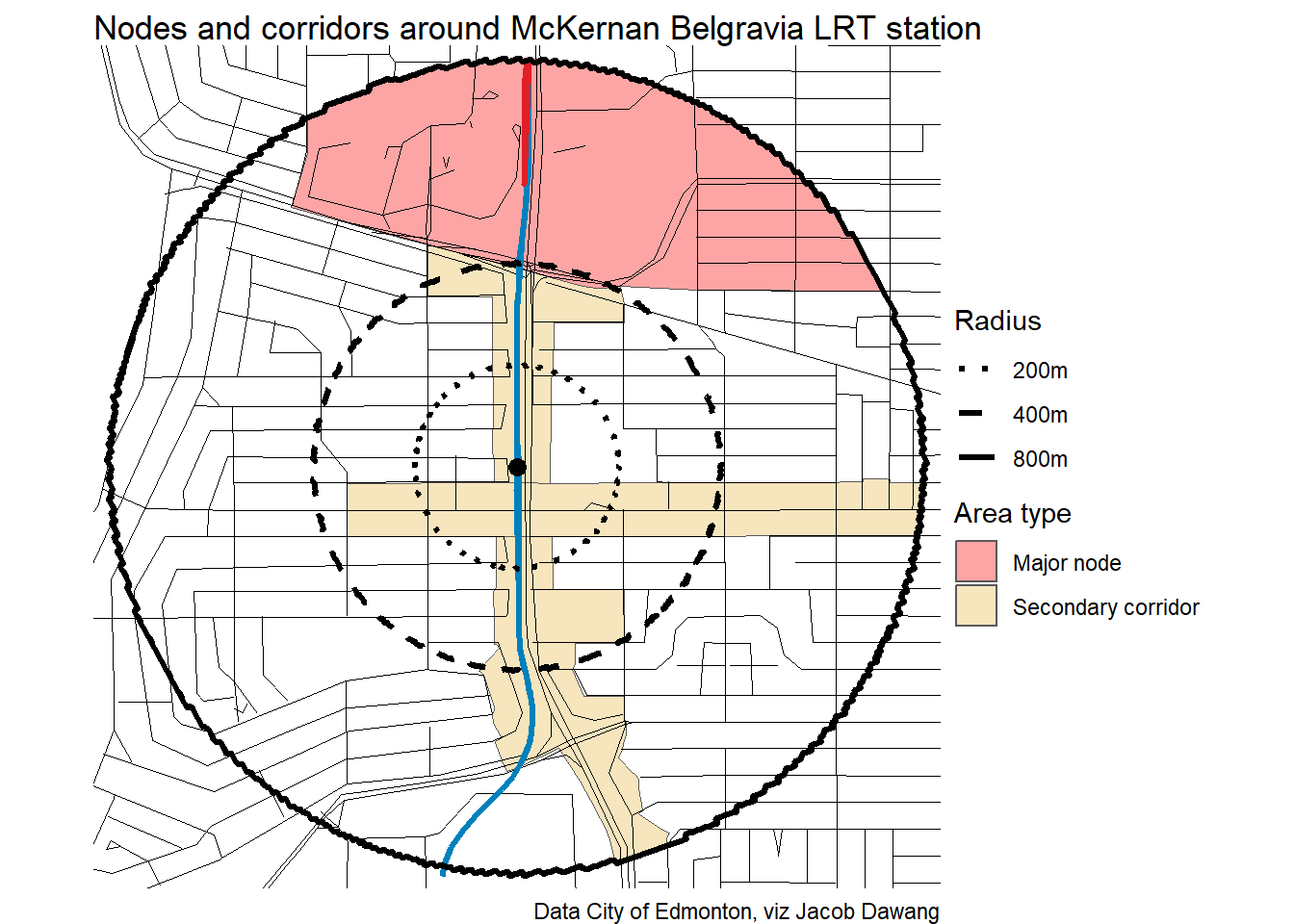
McKernan/Belgravia Station
map
data
housing
district planning
transit
edmonton

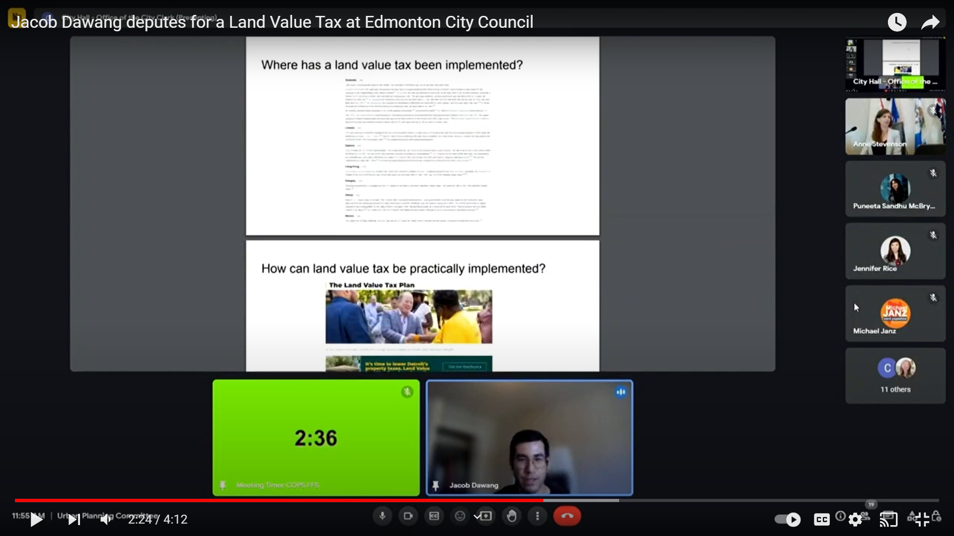
I Deputed for a Land Value Tax at Edmonton City Council
land value tax
edmonton

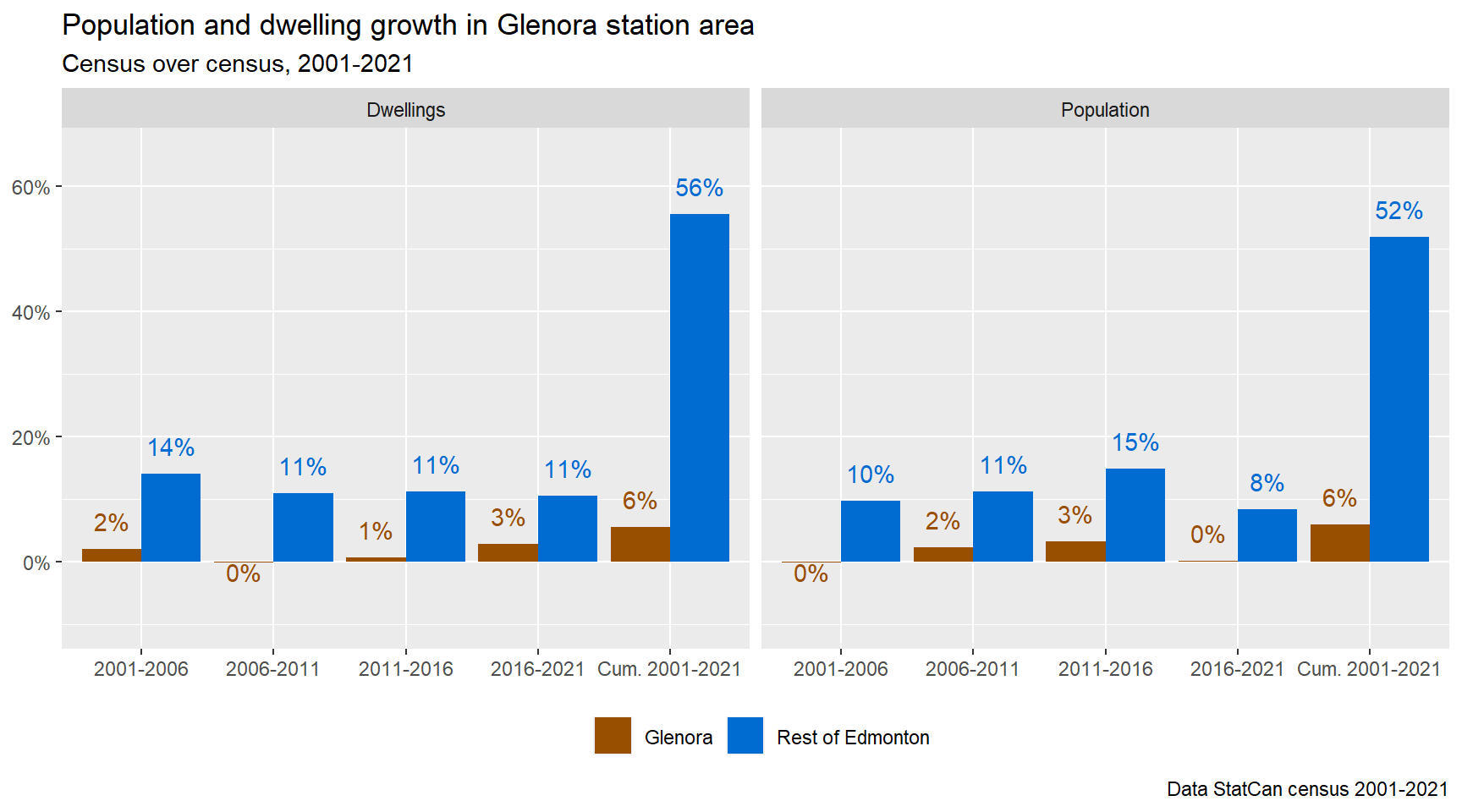
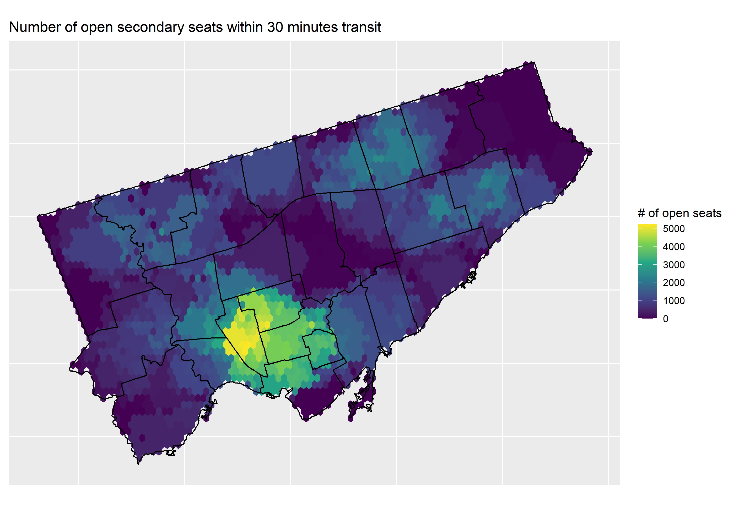
Edmonton’s Mature Neighbourhoods Need Growth
map
data
schools
edmonton
zoning
housing
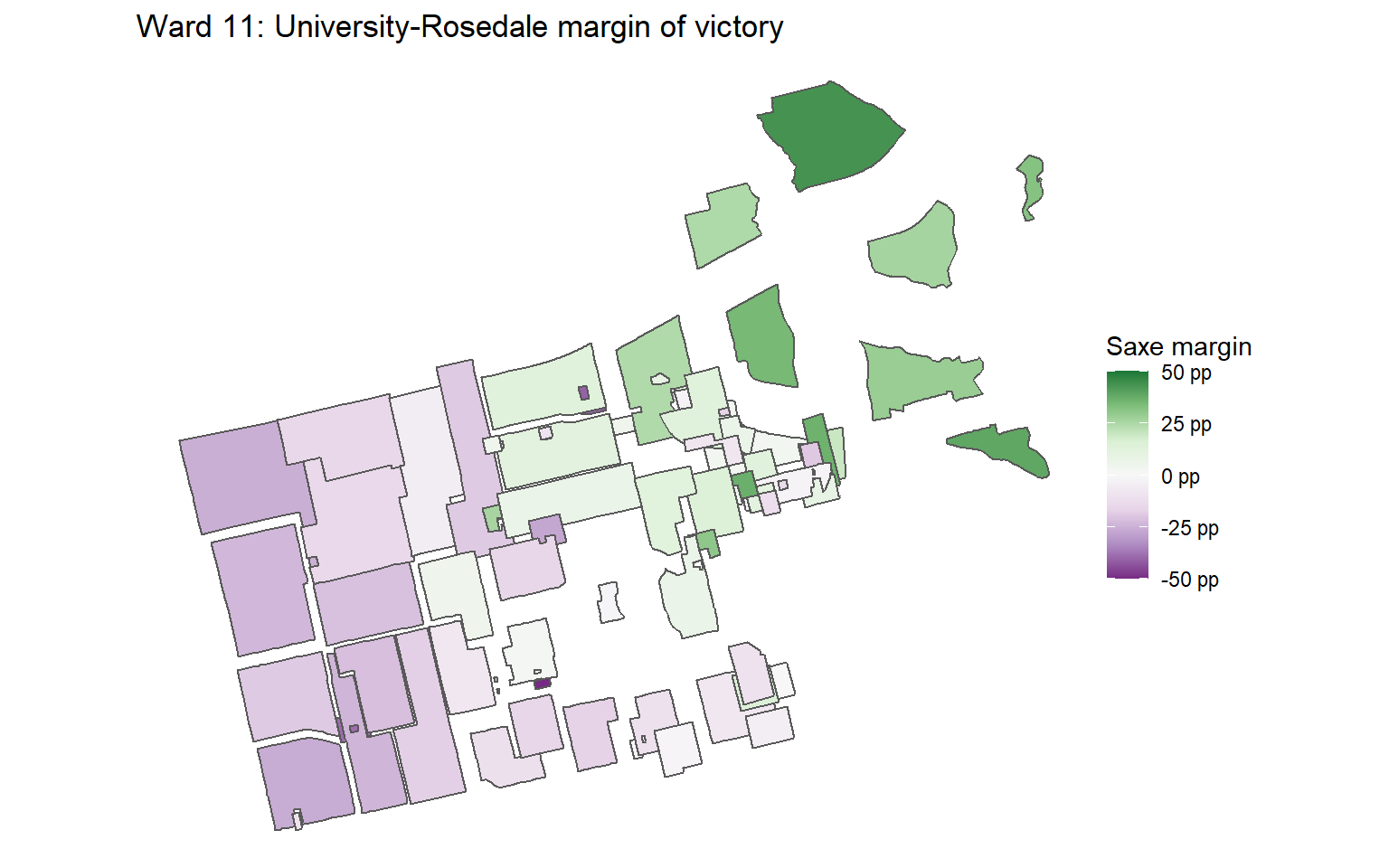
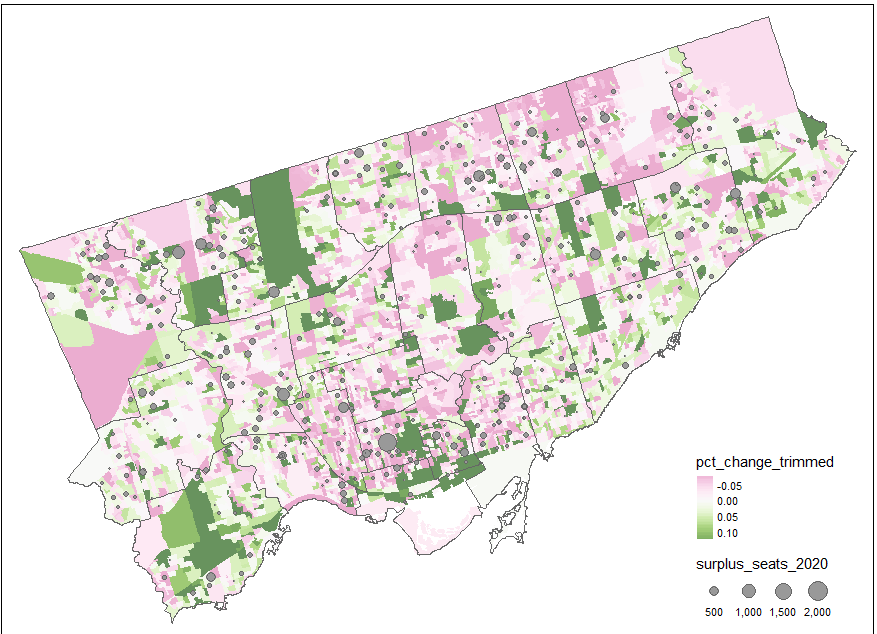
2022 Toronto Municipal Election Maps - Councillors
map
data
election
toronto
No matching items